The Limits of Text Lists: Why Travel Planning Demands Spatial Cartography
Dreaming about world travel in text databases is an incomplete experience. A Notion table listing 'Tokyo, Japan', 'Reykjavik, Iceland', and 'Cape Town, South Africa' captures names and dates, but completely fails to communicate spatial geography, regional clustering, and physical distance.
When planning sabbatical itineraries or logging lifetime travel memories, the human brain relies on spatial mental maps. Seeing countries and continents visually mapped ignites wanderlust and provides immediate clarity for flight route planning and multi-city itineraries.
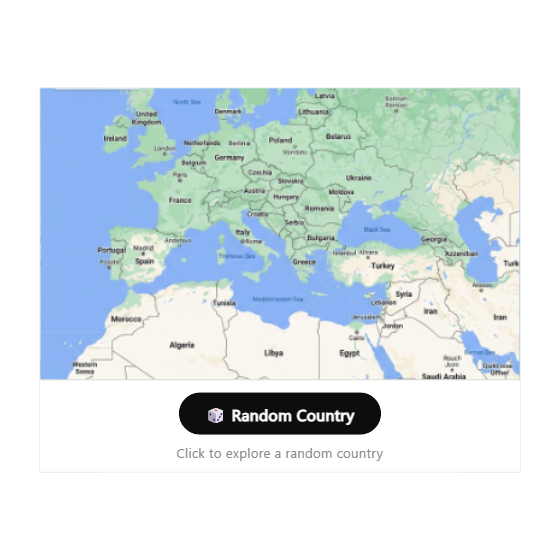
The Random Place Explorer brings dynamic, explore-ready cartography directly into your Notion workspace.
Responsive Cartographic Engineering: Fluid and Explore-Ready
The Random Place Explorer features smooth vector panning, pinch-to-zoom navigation, and a built-in random discovery trigger that teleports the viewport to exciting global destinations. Built with responsive scaling, it fits cleanly across full-page Notion travel dashboards or compact column sidebars.
The map styling adheres to platform standards: zero outer drop shadows, clean 1px perimeter borders, and refined dark and light mode colorways that prevent distracting bright flashes on dark Notion themes.
Four Travel Planning Protocols
The Digital Nomad Expedition Hub
Embed the travel map at the top of your remote work travel dashboard. Visually locate current cities, upcoming flight destinations, and visa-free travel corridors.
Lifetime Travel Scratch Map
Pair the map alongside your personal travel journals. Use it as an interactive visual anchor that showcases your global journey across years of exploration.
Serendipitous Destination Ideation
Use the random teleport button during vacation brainstorming sessions. Let fate pick an unexpected country, then research local culture and flights in Notion notes below.
Dark Mode Travel Wiki Header
Configure the map with an Obsidian Noir palette and sharp 4px corners to establish an elegant, museum-grade cartographic header for your personal wiki.
Architectural Breakdown: Interactive Travel Map vs. Raw Database Table
Database Tables & Records
Best for deep historical storage, relations, and structured records